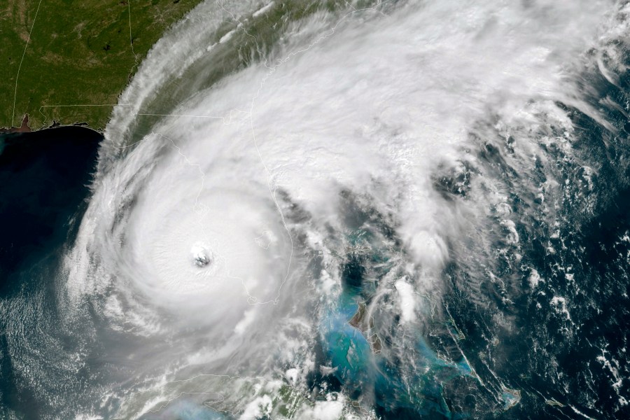
Hurricane Ian has made landfall as a Category 4 storm near Cayo Costa, Fla, an island off the state’s southwest coast.
The National Hurricane Center said Ian made landfall at 3:05 p.m. about 20 miles north of Fort Myers with maximum sustained winds of 150 miles per hour.
The storm is moving at about 9 miles per hour and is expected to move northeast through the state in the coming hours.
State and local officials have issued evacuation orders for more than 2.5 million people, urging residents to leave low-lying areas before conditions further deteriorate.
Images and videos posted online already show flooding in areas in Ian’s path, with Florida Gov. Ron DeSantis (R) asking for additional federal assistance on Wednesday through a major disaster declaration.
Forecasters predict peak storm surges could reach up to 18 feet near where Ian makes landfall, spanning from Englewood to Bonita Beach. Lesser surges are expected elsewhere along Florida’s Gulf Coast and in the Florida Keys.
Ian is expected to weaken as it moves throughout the state, with the storm’s center reaching Orlando tomorrow morning as a tropical storm.
Forecasters say the storm will eventually make its way to the Atlantic Ocean, exiting Florida near Daytona Beach on Thursday evening before making landfall again near the Georgia-South Carolina border.
The National Weather Service has issued hurricane and storm surge warnings for wide portions of the state.